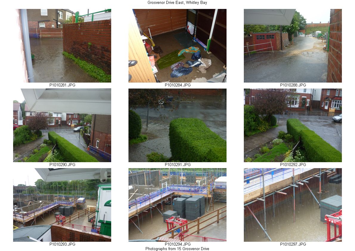
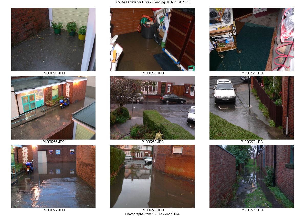
Below are two sets of 'contact prints' showing the flooding that occurred on 28 June 2012 and on 31 August 2005 (before the YMCA was demolished). I have sent both sets with covering emails to North Tyneside Council and to the developer's agent, expressing my concerns about the potential of flooding on the site (and my garage) when the building is completed. This is bearing in mind that much of the site area will restrict the run-off of surface water and that a ground survey indicated boulder clay to a depth of about 10 m. (This could be why water remains visible near the metro line days after the recent deluge.)
R Smith 15 Grosvenor Drive - 8 July 2012 (Updated 15 & 25 July)
Links to high resolution photographs - (best downloaded and viewed offline): -
28 June 2012 flooding - 281 284 288 290 291 292 293 294 297
31 August 2005 flooding - 260 263 264 266 269 270 272 273 274Photographs from LB
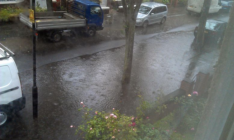
Junction of Grosvenor Drive and Marden Road
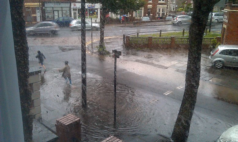
Same heavy pooling as above
(Technical note - EXIF information allows location to be viewed on Google Earth)
Flooding of access road on 24 & 28 June 2012
Flooding of access road on 5 August 2012Gathered below are some YouTube videos of the flooding in the Whitley Bay Area
(These added on 25 July.)
Mega storm hits Whitley Bay