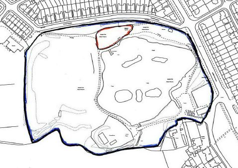
The larger drawing below has been taken from planning application 03/00264/LAREG3 (captured from page 22 of a single document record).
Click on the larger drawing to view a high resolution version that allows the original notes to be read.)
The planning aplication that was approved by committee on 13 March 2003 was for the "Regrading of land to the north west of the pond and erection of sandstone footbridge". (It also included the erection of a metal fence around most of the park area where previously there was no fence or to replace a wooden fence.)
The planning officer's report summarises the proposal: -"The application proposes the regrading of an approximate area of 350 square metres land to the north west of the lake and the installation of a raised footpath which bridges a concrete pipe which discharges into the lake. The works are necessary in order to improve drainage to this part of the Nature Reserve, which is currently susceptible to flooding. "
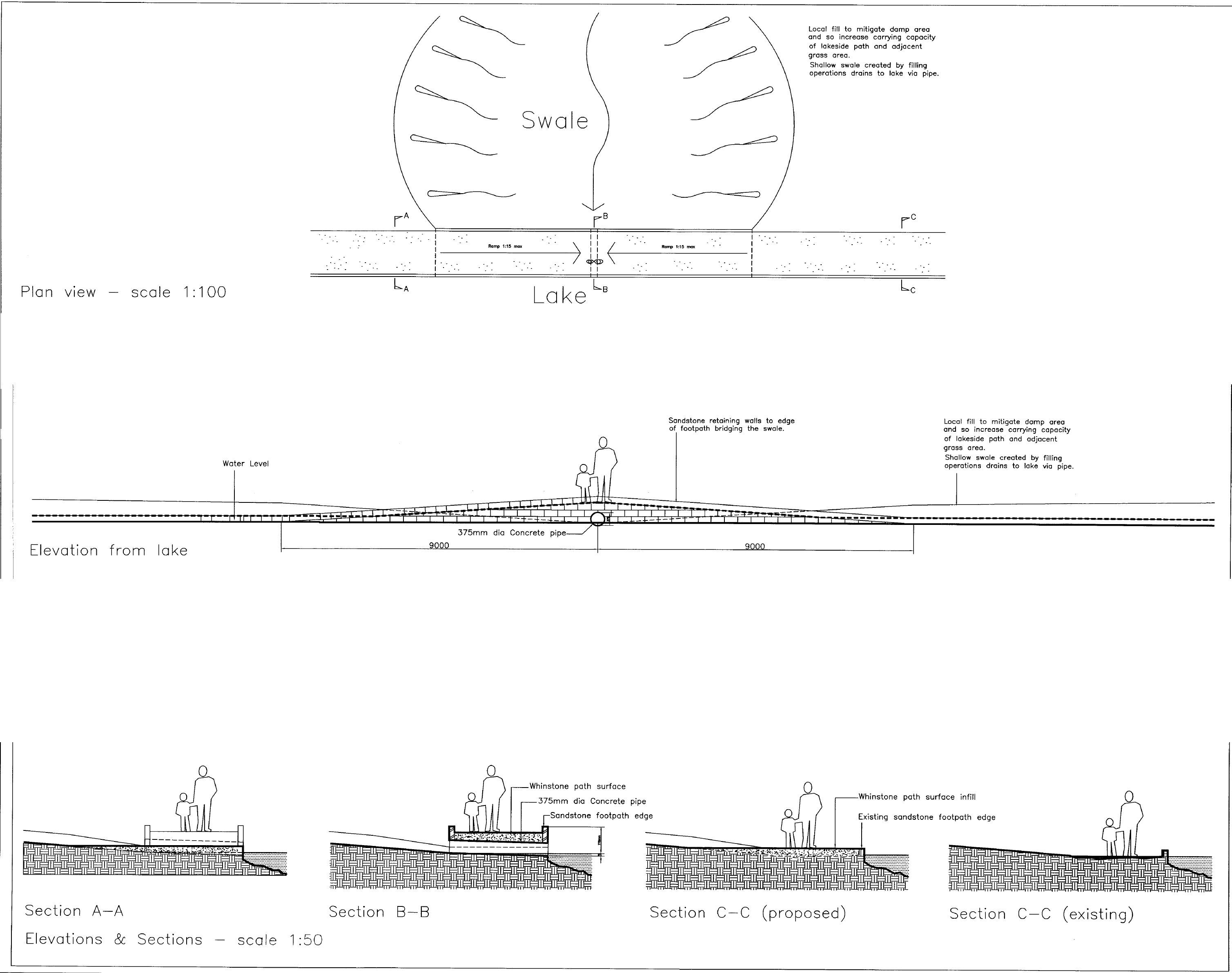
"Topsoil, whinstone and sandstone will be imported to regrade the land. The land will be filled to make it a swaled area, which will result in the land being increased in height by at most 800 mm. A footpath link will be established which bridges the new drain to be laid under the swale. The footpath links into the existing footpath circuit around the nature reserve." "What is a swale?" - link added 20 May, 2017.
The area of land referred to is outlined in red in a diagram taken from the planning application: -
A swaled area is a depression in the land designed to take any rainwater running off the surrounding land during unusually high rainfall. It is clear from the design shown in the larger drawing that this water is intended to be drained from the swaled area to the lake via a single, 375 mm diametec oncrete pipe. Note that the pipe shown slopes downwards from the swaled area to the lake water level. (The design seems to have assumed a fixed lake water level !)