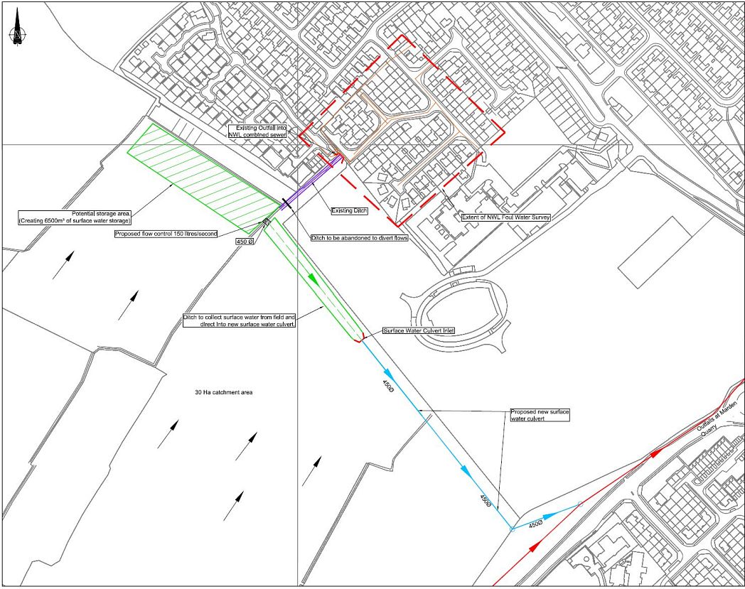
This page updated on 10 March, 2018 #

Flood Prevention Schemes Proposed for Murton Gap North & South Catchment Areas
(High resolution graphics taken from 15/02056/FUL and 16/01956/FUL - Schematic Drawings + Options for Development Site)

Click on graphics below for high resolution versions!
( each will open in a separate tab/window for ease of comparison.)

Northumbrian Water Publication (8 page pdf file) #
Northumbrian Water Video ("Murton Gap - Surface Water to Sea")
#

North Catchment Area
(Before Housing Development)

T

South Catchment Area (Briar Vale)
(Before Housing Development)


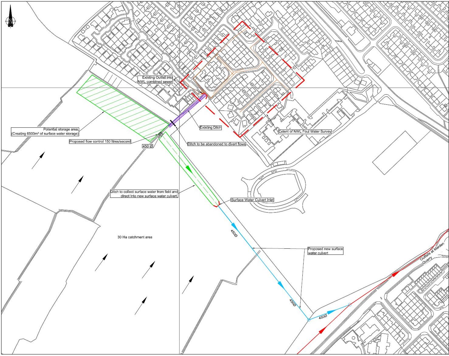
Options for Site Housing Development
Option 1 (Enlarged Ponds)

Option 2
(Additional & Enlarged Ponds)